
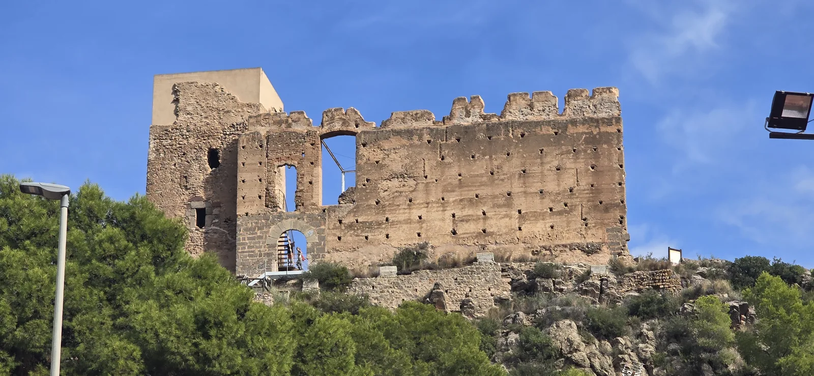
Estivella () is a small town in the Camp de Morvedre, about 40 minutes' drive north of Valencia, and its hamlet of Beselga () is the start of one of the most rewarding half-day walks in the Serra Calderona. In nine kilometres you pass a medieval castle, climb to the red sandstone balcony of the Garbí () and, on a clear day, look out over the coastal plain to the Mediterranean.
Our roundup of hikes near Valencia lists the Garbí as an 8 km (about 5 mi) out-and-back. This is a different route: a loop that starts lower, at the castle, climbs by one waymarked path and comes down by another, so you never walk the same ground twice.
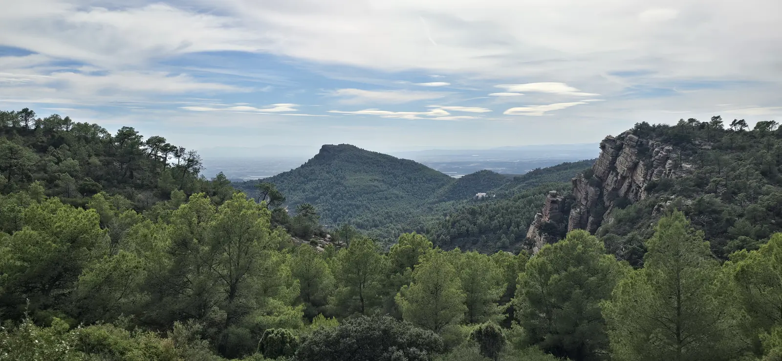
Photo: Michael Bastin, ValenciaMove
The Beselga to Garbí loop at a glance
- Distance
- About 9.2 km, circular
- Ascent
- About 500 m
- High point
- The Mirador del Garbí, just under 600 m
- Walking time
- 3 to 3.5 hours, plus stops
- Difficulty
- Moderate, no scrambling
- Waymarks
- Red and white (GR 10 branch), then green and white (SL-CV 24)
Distance, ascent and high point come from GPS tracks of the loop, which agree to within a few tens of metres. The Generalitat's tourism board gives the Garbí summit itself as 601 m (about 1,972 ft). The walking time is our estimate, built from the federation's own timings for the two waymarked sections.
The Beselga to Garbí route, step by step
From Beselga past the castle to the Font de Barraix
Start in the hamlet of Beselga, by the small ermita de Sant Roc (). A path beside the chapel climbs in a few minutes to the castle, which deserves a proper stop (see the castle section below).
From the castle, follow the red and white waymarks of the GR 10 branch to Estivella. The Valencian mountain sports federation, FEMECV, describes this branch as following the old Beselga drove road between Estivella and the Font de Barraix (), and you walk it in reverse, gaining height steadily through pine woods on a comfortable path.
The Font de Barraix is a stone fountain where the path reaches the houses of Barraix. Treat it as a landmark rather than a water stop, for the reasons in the practical section below.
The climb from the Font de Barraix to the Pla del Garbí
Beyond the fountain the route leaves the GR and turns south up the barranc del Garbí, where the climb steepens. Near the top the path comes out in the area of the Pla del Garbí, the flat ground below the viewpoint.
The Generalitat's panel at the trailhead near the top describes the view from the Pla. Straight ahead is the Mola de Segart, with the gulf of Valencia beyond it, and to the right is the Puntal de l'Abella, a flora microreserve. On clear days, the panel says, you can make out the Albufera natural park and even the Montgó.
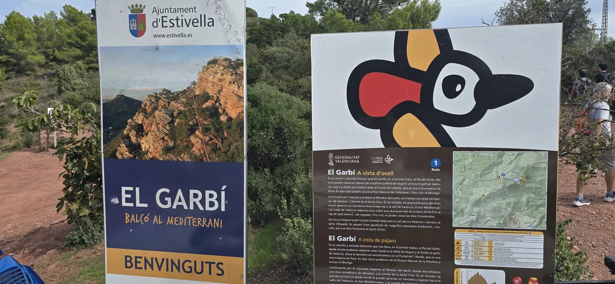
Photo: Michael Bastin, ValenciaMove
The Mirador del Garbí and the ermita de la Santa Creu
Bear left from the Pla and you reach the Mirador del Garbí, a railed balcony on the edge of the sandstone cliffs, with a recreation and rest area and the small ermita de la Santa Creu beside it.
According to the same panel, the view runs over the Palancia valley, the Mediterranean and the city of Valencia, from the Serra d'Irta to the Cap de Sant Antoni, and on some days as far as the Columbretes Islands.
Down the Senda Vella (SL-CV 24) back to Beselga
The way down is the Senda Vella (), the old path to the Garbí, waymarked as SL-CV 24 in green and white. FEMECV gives it as 2.6 km (about 1.6 mi) with 380 m (about 1,247 ft) of height difference, so it is steep and stony in places: take your time and use poles if you have them.
It brings you out on the Beselga road, a short walk from where you started.
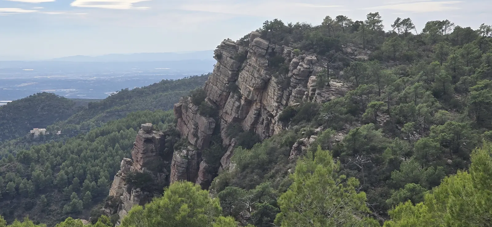
Photo: Michael Bastin, ValenciaMove
Beselga castle: the Almohad tower and the palace beside it
Beselga castle is two buildings in one. The older is a square watchtower that the Diputació de València's tourism service dates to the 12th century, under Almohad rule. It stood on the line of lookout towers that watched the Palancia valley road from Sagunto to Jérica, and it is built of rammed earth, which is why its walls are dotted with rows of small square holes.
The second building is a palace added beside the tower in the late 15th century for the baron Gracià de Monsoriu. The Ajuntament d'Estivella describes it as more a lordly residence than a fortress, with Gothic twin windows on its upper floor. It was destroyed in the first third of the 16th century.
Its north wall collapsed on 7 July 2004. The restoration that followed rebuilt the tower and consolidated what survives of the palace, and the castle has been listed as a Bien de Interés Cultural, Spain's highest heritage protection, on the Ministry of Culture's register since 2002.
Stairs and railings let you climb inside the tower, and information panels explain the site. A 2023 visit report found corroded steps and litter. When we photographed the castle in October 2026, visitors were using the stairs, but go carefully and keep children close.
Getting to Beselga by car or by Cercanías train
By car, Beselga is about 37 km (about 23 mi) from the centre of Valencia, roughly 40 minutes without heavy traffic on the V-21, the V-23 and the A-23 towards Sagunto and Teruel. We know of no signposted car park for walkers, so leave the car on the streets around the Plaça de l'Ermita without blocking garages or the narrow lanes.
By train, Cercanías line C5 (València Nord to Caudiel) stops at Estivella-Albalat dels Tarongers. The station is about 2.3 km (about 1.4 mi) from Beselga by road, so add roughly half an hour's walk each way. C5 trains are infrequent, so check the timetable on the Renfe website or app for both directions before you set off. In October 2026 Renfe's Valencia Cercanías page listed no disruption on the line.
When to hike the Garbí, water, shade and fire rules
Go between October and May. Summer days in the Calderona are hot, and the upper half of the route is exposed rock with little shade, so in warm months start at first light.
Carry all the water you need, at least a litre and a half each. Mountain springs can run low after dry spells, and we could not confirm that the Font de Barraix flows all year. Wear boots or trail shoes with a good grip, because the Senda Vella descent is steep and loose in places.
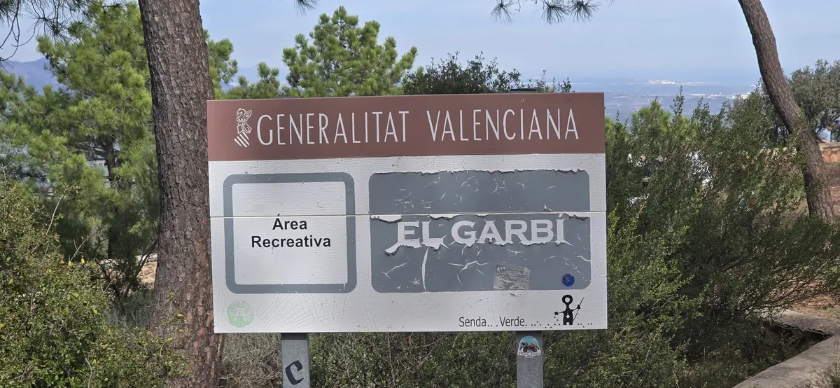
Photo: Michael Bastin, ValenciaMove
The Mirador sits in the Generalitat's Àrea Recreativa El Garbí, a recreation and rest area inside the natural park, and the same fire rules apply there as on the paths.
Check the fire risk before you go. The Serra Calderona has been a natural park since 2002, and in periods of high wildfire risk the Generalitat can close its tracks and paths to walkers, as it did in July 2026. Our guide to wildfire rules in the Valencia region explains the preemergency levels. Never light a fire or a stove on the mountain.
To make a day of it, Sagunto's Roman theatre and castle are a short drive down the A-23, and our Sagunto day trip guide covers them. If you liked this walk, the Chulilla hanging bridges hike is the obvious next one.
Settling into Valencia's countryside as much as the city?
Walks like this one are part of why people choose to live near Valencia rather than just visit it. If you are weighing up where to settle, we can help you compare the options.
Contact us
About the author
Michael Bastin
Founder, ValenciaMove - Valencia since 2016
Michael moved to Valencia in 2016 and has helped dozens of families relocate since. He writes every guide on this site personally and verifies every fact against Spanish government sources before publishing.
Buy Michael a coffeeNeed help with your move?
Contact us. We handle visa, admin, and housing so you can focus on the exciting part.